International Geographic Information Systems (GIS) Day - November 20, 2024 | “Mapping the Minds, Shaping the World: 25 Years of GIS Excellence”

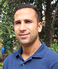
Mr Amjed HADJ TAIEB
NRM, Geo-information in environmental management Engineer,
Sahara and Sahel Observatory
Who would have thought that one day, our traditional maps would turn into real digital dashboards? On this 2024 International GIS Day, celebrating the theme “Mapping the Minds, Shaping the World: 25 Years of GIS Excellence”, Africa has a greater say than ever!
Times of memorizing every trail, every watering hole are long gone! Today, Africa is using Geographic Information Systems (GIS) to address its most pressing challenges. Several major GIS projects are currently being deployed across the continent, from crop monitoring in the Sahel to elephant tracking in southern Africa.
Being able to predict the next harvest while sitting on your phone, or knowing the available water reserves with a simple click! Looks like science fiction, doesn't it? May be, but it is the reality of the GMES&Africa program (Global Monitoring for Environment and Security & Africa). This joint initiative between the African Union and the European Union is working wonders in Africa. What is the secret? Using satellite data to track our resources, map the slightest variations in terrain, carry out real-time monitoring of the ecosystems and anticipate water and food needs with great precision. In this context and in North Africa, the results of GIS and remote sensing are remarkable. Farmers benefit from seasonal forecasts and are therefore able to improve the estimation and forecasting of agricultural yields. The services have thus become indispensable to accurately map crop areas and to provide early warnings in the event of water stress and climate variability.
SAQIYA, a mobile application for controlling irrigation, was developed by the GMES North Africa Consortium as part of the GMES&Africa project, and aims to help farmers optimize the management of water resources for crop irrigation. Thanks to its advanced features, this application allows for more efficient use of water, preserve the plant condition, optimize water use and get a better agronomic performance. In short, SAQIYA is a top tool for farmers to control irrigation and improve crop yields.
Let’s take the example of a few countries for a clearer illustration of this transformation.
In Burkina Faso and Tunisia, the Digital Earth Africa project has tracked long-term degradation trends and dynamics, providing a valuable overview for decision-makers to better understand and combat this phenomenon. By providing up-to-date information, Digital Earth Africa is helping inform land restoration policies and actions, with a view to sustainable development.
In Kenya, the project is using GIS to help several smallholder farmers optimize their harvests.
(https://www.digitalearthafrica.org/taxonomy/term/1; https://www.digitalearthafrica.org/media-center/blog/delivering-higher-yields-farm-market).
In Senegal, as part of the Copernicea project, water management is undergoing a digital revolution: ecosystem accounting for water analyzes the water cycle as well as all the interactions, exchanges and transformations related to this resource. It also makes it possible to measure the degradation of ecosystems that can be caused by the depletion and pollution of water resources. Morocco is also using GIS to plan its sustainable cities.
(https://crts.gov.ma/cartographie_evolution_urbain.html; https://crts.gov.ma/cartographie_urbaine.html).
Of course, there are still many financial and material hurdles to overcome. But African GIS experts have big plans for the next few years: mapping of climate risk areas, real-time tracking of the deforestation to preserve forests, and improvement of urban planning to, hopefully, cut with the traffic jams.
It goes without saying that we need to learn about GIS. Many African universities now offer dedicated programs. In addition, taking part in participatory mapping projects within your community and sharing your geographic data is becoming increasingly crucial.
The saying goes: "Prevention is better than cure". With GIS, we can do both. So, let us celebrate these 25 years of innovation, and prepare for the next years of smart mapping!
This International GIS Day is not just a celebration, it is a reminder: Africa is no longer a picture on the maps, Africa is drawing these maps!
